Soil Sampling Options
Zone Sampling
Fields are zoned with up to five management zones, creating a MZB* Lite Zone Map. Lite maps may include two topography zones and low, medium or high yield potential zones . Elevation and a yield-potential layer are used to create the management zones. The yield-potential layer is established using satellite imagery or yield data. Elevation data is derived from LiDAR. Sample points are collected and archived using RTK. We can store sampling maps and harvest data for future use in precision technologies.
Grid Sampling
Grid sampling reveals how the nutrients are distributed across a field. By collecting soil samples in 2.5 acre RTK grids to give you an understanding of what is going on in your field at a smaller level. We can store sampling maps and harvest data for future use in precision technologies.
Composite Sampling
Subsamples taken from an entire field to get an average fertility need for that field.
ALL ANALYSIS INCLUDE
N, P, K, S, Micros, Organic Matter & Fertility Recommendations
Scouting Options
Row Crops - Corn, Soybeans, Small Grains & Alfalfa
Premium
For the grower who is looking to maximize profits while truly understanding their farm.
- 6 In Season Field Visits With Scouting Report & Recommendations
- Stand Counts For Quality Control
- Tissue Tests With Recommendations
- NDVI Drone Flyover To Reveal Deficiencies
- Crop Season Plan With Budget
Preferred
Looking for the next step in crop production?
- 6 In Season Field Visits With Scouting Report & Recommendations
- Stand Counts For Quality Control
Principle
Do you want the first step to improve your crop production or just trying to do a little better on your farm?
- 3 In Season Field Visits Across Every Acre With Scouting Report & Recommendations
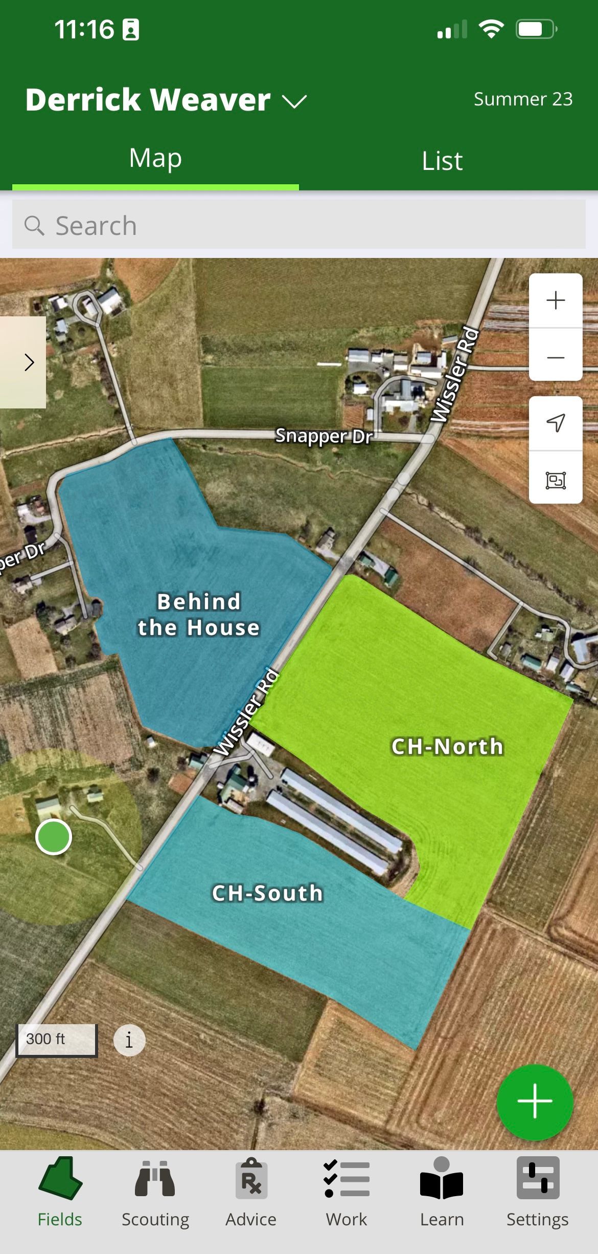
Our Scouting Portal
- Dynamic Field Maps With Cropping History
- Archived Scouting Reports & Recommendations
- Compliant Farm Pesticide Application Records
- Soil Sample Record Archive Connected To Field's Shape File